Shelley Alexander
Shelley Alexander leads the University of Calgary Canid Conservation Science Lab, where they deploy non-invasive field methods, qualitative and quantitative research design, and geospatial analysis to tackle questions about or find solutions to human-wildlife conflict. She also conducts research on animal welfare, attitudes and values towards wildlife, habitat fragmentation, linear (i.e. road) disturbance, and critical habitat designation for endangered species.
Darren Bender
Darren Bender’s research interests are in the field of geospatial information systems and analysis, particularly at the interface of biology and geography. His current research integrates quantitative spatial tools into ecological research, with particular interest in geospatial methods for habitat assessment, spatially-explicit population modelling, geostatistical species-range estimation, and GIS-based biodiversity assessment.
Stefania Bertazzon
Stefania Bertazzon’s research focuses on health geography, employing spatial analysis to study environmental and socioeconomic determinants of health. She develops reliable analyses in the social and health sciences and leads the Geography of Health group, with the O’Brien Institute for Population Health. Stefania collaborates with health researchers, Health Canada, and Environment Canada. Recent projects include modelling air and ocean pollution, analysing environmental exposures, and association of health with socioeconomic factors and built environment.

Gwendolyn Blue
Gwendolyn Blue joined the Geography Department in 2010, transferring from the Faculty of Communication and Culture where she taught courses in Science, Technology and Society. Research interests lie with civic science, public engagement with techno-scientific issues such as climate change and food safety, science communication as well as post-humanist, material approaches to public engagement. She is currently working on a SSHRC funded research project on citizen participation in environmental governance, with a focus on climate change.

Conny Davidsen
Conny Davidsen’s research focuses on the political process and governance behind changing environmental policies, especially from a political ecology perspective. This involves international policy discourses on forests, climate, energy, and carbon, as well as sustainable resource management and local extraction conflicts, including indigenous tenure rights. Her regional focus is on Latin America and Western Canada, with other involvement in Nepal, Bangladesh, Nunavut, Kenya, and Mongolia.
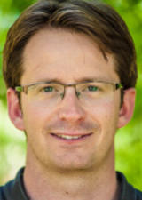
Brent Else
Brent Else's research primarily focuses on carbon cycling in the changing Arctic marine environment. He is interested in how gases — particularly CO2 — are transferred between the atmosphere and the Arctic Ocean. Brent is also interested in the biological, chemical, and physical processes that control gas exchange. The motivation for his research lies in understanding the role that the Arctic Ocean plays in absorbing CO2 (and hence impacting climate change), and in the consequences of CO2 absorption for ocean acidification. His areas of expertise include chemical oceanography, micrometeorology, sea ice biogeochemistry and thermodynamics, and remote sensing.

Victoria Fast
Victoria Fast's field of research is broadly urban GIS; an interdisciplinary mix of geographic information science (GISci), human geography, and urban studies. With specialized knowledge of spatial and open data, smart cities, spatial analysis and modelling, participatory GIS, and volunteered geographic information (VGI, or geographic crowdsourcing), Dr. Fast applies that knowledge to study—and advocate for—urban and pedestrian environments that are vibrant, safe, and inclusive of people with disabilities. This includes mapping, modelling and analyzing: sidewalk condition, urban and building accessibility, urban density, pedestrian collisions, accessible mobility, and active transit.

Andrea Freeman
Andrea Freeman, our current Department Head, is a geoarchaeologist, who primarily researches the dynamic among past societies and landscapes. She is particularly focused on river valleys and their potential to attract human groups and preserve record of their presence. Andrea’s current research involves sediment storage along tributaries of the South Saskatchewan in southern Alberta, and she has been involved in examining the potential of late glacial landscapes to draw early human groups into Alberta.

Geoff Hay
Geoff Hay has over 25 years’ experience in GIScience – specializing in Urban Energy and the Environment. He is a recognized leader in GEographic-Object Based Image Analysis (GEOBIA). His research integrates automatic feature detection with GeoWeb technologies, crowd-sourcing, data-mining and high-resolution (thermal) remote sensing to support urban energy efficiency and to better understand urban form through scale. His research team won the MIT Climate CoLab Grand Prize for the HEAT Geoweb project, winning from over 400 contestants world-wide. He continues to commercialize this project with his team.

Wil Holden
Wil Holden’s current research interests include: the Philippines, mining, climate change, insurgency/ counterinsurgency warfare, state terrorism, memoryscapes, and performative violence.
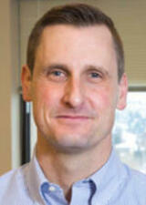
Chris Hugenholtz
Chris Hugenholtz specializes in geomorphology - the study of Earth-surface processes and landscape dynamics. His research approach combines field measurements, numerical modeling and laboratory experiments. He is also a leading expert on the application of small unmanned aircraft systems (UAS; a.k.a. drones) for mapping, remote sensing and atmospheric measurements. Chris' current research activities include a Mars analog project in the Andes, a UAS-based pipeline leak detection system, UAS mapping accuracy and change detection, and aeolian (wind) bedform dynamics on Earth and Mars.

Dan Jacobson
Dan Jacobson’s research explores how individuals understand geographic space in the environment, combined with their interpretations of representations in cartography and geographic information systems. Specifically he focuses on multisensory access to digital mapping for non-visual users. Dan’s current research activities include digital humanities, integrating historical documents with geographic information.

Shawn Marshall
Shawn Marshall studies glaciology and climatology in western and Arctic Canada. His research group combines field studies with computer models of cryosphere-climate processes to examine glacier response to climate change and associated impacts for regional water resources and global sea level rise.

Yvonne Martin
Yvonne Martin is involved in research projects considering connections between geomorphology and ecology, operation of hillslope and fluvial processes and drainage basin development over millennial time scales in western Canada. Her research projects utilize field and/or numerical modelling approaches. Yvonne is Associate Director of the Biogeoscience Institute at the University of Calgary and has served on the NSERC Committee to evaluate Discovery Grants in Geosciences.

Greg McDermid
Greg McDermid is a geospatial scientist whose research activities revolve around the application of remote sensing and other geospatial technologies to environmental monitoring and ecology. He is involved in a wide variety of interdisciplinary research collaborations in the fields of wildlife ecology, biodiversity assessment, ecological monitoring, plant-phenology assessment, and vegetation mapping. Greg is interested in a broad range of remote sensing and other GIScience pursuits, including digital image processing, spatial analysis, environmental modelling, and data fusion/integration.

Byron Miller
Byron Miller’s recent work focuses on the spatial constitution of social movements, urban governance and governmentality, and the politics of urban and regional sustainability. He is currently involved in research projects on the Social and Environmental Implications of Smart Cities, Neighbourhood Change (in Calgary), and Global Suburbanisms. Byron teaches courses on urbanization and planning, urban social geography, urban politics and governance, globalization, and field courses on urban sustainability in Europe. He also serves as Coordinator of the Urban Studies Program.
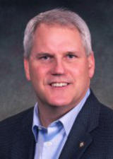
Brian Moorman
Brian Moorman’s research focuses on the interface between permafrost and adjacent environments, whether that be glaciers, rivers or the ocean. He is particularly interested in how glacier meltwater travels from the glacier environment out into the permafrost environment. His study areas are predominantly in the Canadian Arctic. Currently, he is conducting a long-term glacier and permafrost hydrology study on Bylot Island.

Darren Sjogren
Darren Sjogren joined the Geography Department in 1997 as an appointee for the Earth Sciences Program. His research program focusses on sub and proglacial environments and incorporates digital terrain modelling, remote sensing and shallow geophysical techniques.

Tricia Stadnyk
Tricia Stadnyk's research looks at continental scale water supply under climate change through three main foci: development of new data networks to support hydrologic modelling, development of tracer-aided hydrologic modelling tools, and quantifying risk-based uncertainty for operational prediction of climate change impacts. Applications of her work include analysis of changing pan-Arctic water supplies under climate change and associated impacts at the freshwater-Arctic marine interface. She specializes in using integrated modelling approaches, specifically water isotope tracers and isotope-enabled models, to improve regional hydrologic process detection, diagnosis of change, model calibration, and quantification (reduction) of model uncertainty.

Eliot Tretter
Eliot Tretter's current research focuses on urban sustainability with a concentration on the tensions that exist between meeting both ecological and social sustainability objectives. He also studies the development of the urban knowledge economy, particularly the role of universities in urban and regional development. Eliot has a regional specialty in both Northern Europe and the Southern United States. He enjoys giving public lectures and has engaged in a number of research projects with his urban studies students and community organizations, which have resulted in concrete local benefits. Eliot is the Undergraduate Advisor in the Urban Studies Program.

Aaron Williams
Aaron Williams is an Instructor teaching human, urban and physical Geography courses. His responsibilities include coordination and instruction of multiple international field schools offered by the department of Geography in Europe and Southeast Asia. His current research focuses on international postsecondary field program scholarship and practice, and natural disaster aid, recovery, and redevelopment.

John Yackel
John Yackel’s research lies in Arctic sea ice processes with an emphasis on the role that snow thickness distributions and atmospheric processes play during the sea ice growth and melt seasons. A key focus is on the use of polarimetric microwave remote sensing as a tool for measuring, monitoring and modelling the snow cover properties on sea ice through its annual cycle.

